From an unreal village to the big cross
itinerary on the Valdarno slopes of Pratomagno: from Rocca Ricciarda to the cross
Texts and photos by Alessandro Ferrini ©
80 images in sequence to learn about this itinerary in Pratomagno. Click to start the virtual excursion
From the medieval village of Rocca Ricciarda to the Pratomagno ridge
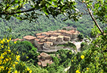
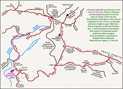 With the ring itinerary that we describe in these eighty pages, we will cover three kilometers of the splendid and panoramic Pratomagno ridge, but we will also walk on the steep and fascinating Valdarno slopes of the mountain. We will know Rocca Ricciarda, a tiny village at 943 meters above sea level that as soon as we see it, a question will immediately arise in us: how can a place like this exist? We will walk along the Ciuffenna stream full of many small waterfalls. In addition to the 360-degree panoramas that the upper part of Pratomagno will offer us, even lower down we will encounter other beautiful views of the valley floor and the steep slopes of the massif characterized by the presence of rocky areas. The itinerary can have various starting points, depending on where we come from: Varco ai Gioghi (Pratomagno tunnel) or Pian del Lelli if we are coming from the Casentino, Rocca Ricciarda if we are in Valdarno. We, in the description we make, have decided to start from this characteristic village that we recommend visiting before the excursion. At the end of the walk, then, we will be able to refresh ourselves with some delicacies prepared by the small tavern, first of all the chestnut flour pancakes. From this starting point, in the first three kilometers we will immediately face the most demanding part of the route which is to be considered a medium-high physical effort, not so much for the length, but for the height difference. From the 900 meters above sea level of the ancient mill of Rocca Ricciarda we will go up to the almost 1600 meters of the cross of Pratomagno and Poggio Pianellaccio, then we will have to go back down to the starting point. There are some points to be approached with caution, but nothing dangerous. The itinerary has a length of about thirteen kilometers and a total height difference of almost 1900 meters. Rocca Ricciarda can be reached in nine kilometers from Loro Ciuffenna following the signs for FRAZIONI MONTANE. During this journey by car we will cross the beautiful Ciuffenna stream along which we will then walk. Arriving in this village we find ourselves next to that rocky spur which characterizes the morphology of this place. It is possible to climb it via a sort of huge, very inclined stone slab. Which the boys reluctantly give up. We tackle this short climb after making sure that the rock is dry and our shoes have excellent grip. Descending is perhaps more problematic, many prefer to do it backwards with their hands resting on the stone. From up here we can imagine what Rocca Guicciarda was like in the Middle Ages (this is how the place was originally called, from the name of a certain Count Guicciardo da Loro who lived there).
 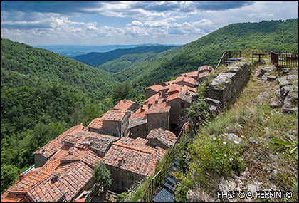 A few meters from us, on a sort of micro plateau on a rocky outcrop (we can't get there from here) are the ruins of what was once the fortress. Beyond this, below, we see the small village, while in the background a narrow valley opens up which allows us a spectacular view of the Valdarno. It is clear that the intention of the feudal lords who built this small castle in the 12th century was to have visual control over the valley floor, but mainly to be able to control a road system that crossed the Pratomagno and that probably, with the walk we are about to do, we will trace at least partly. These feudal lords were the Guidi Counts, best known for being the lords of the upper Casentino and owners of powerful castles such as Romena, Porciano, Poppi, San Niccolò. Owning fortresses and forts on the Valdarno slopes of Pratomagno meant having a sort of control wall over their main territory on the western slope. Also on the Valdarno part of Pratomagno, the Guidi family owned other castles near Rocca Ricciarda such as Trappola and Anciolina, Poggio della Regina and, a little further away, the current Castiglion Fibocchi. Between the end of the 13th century and the first decades of the 14th we see the beginning of the crumbling of feudalism in the Valdarno in favor of the Florentine Republic which advances in its domains. There was a very powerful Florentine family, the Ricasolis, who with Bindaccio undertook a sort of challenge with the Republic and, playing in advance, in 1329 bought Rocca Guicciarda and much of the mountain territory around it from the Guidi. After his death, the Signoria of Florence confiscated these assets from the noble family. In 1564, however, Cosimo I, in gratitude for the important services rendered by some members of the Ricasoli during the war against Siena, returned this area of Pratomagno to the powerful family and they regained possession with the title of Baroni. We are now in the late Renaissance and a defensive fortress makes little sense, so it is left to ruin. It was the period that a village began to be born to accommodate the many workers engaged on this mountain: shepherds, farmers, woodcutters, charcoal burners. That village that will grow up to the end of the 19th century and that we can visit today. A narrow alley runs inside this tiny village which could not afford to waste a single inch of land during the construction phase. A metal staircase allows us to climb that rocky outcrop where we can see the ruins of the ancient fortress. Remains well valued by a demanding excavation conducted by the University of Florence between 1997 and 2001.
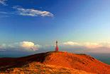
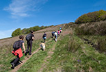
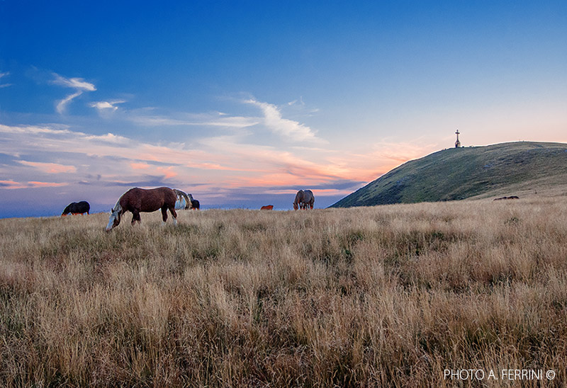
  The small village is below us, with all the houses attached to each other. From up here the view over the Valdarno is exciting, as is the view towards the highest part of the Pratomagno where the tip of the large cross can be distinguished. With our excursion we will have to get up there, let's think of something else! At the beginning of the village, upon arriving, there is the Osteria Bar La Rocca. It is open every day in July and August, on weekends and public holidays the rest of the year. Some of his delicacies are always available, for lunches or dinners it is necessary to book - 347.5552978. At the end of the town we find a clearing where we see a chapel. We have reached what was once the burial ground of Rocca Ricciarda, now in disuse for many years. Here there is a bench to enjoy the extraordinary panorama towards the valley floor while seated. The lumberjacks and shepherds of Rocca Ricciarda went daily, in order to live, in the woods and on the large mountain meadows, using the same routes that we are about to face in this excursion. Therefore, a visit to the small village will certainly be useful for us to identify ourselves with this journey that the time has come to begin. A few meters before entering the town, on the left, a road marked as CAI 21 begins. In about three hundred meters we go down to a bridge on whose left, a little higher up, we see a building: it was the Rocca Ricciarda mill. Thirty meters after the bridge, still to the left, a mule track climbs steeply which shows us a nice pavement. We must take this route which is still the CAI 21. Even the road that continues straight on, flat, continues to be the CAI 21. It leads to Poggio di Loro, another wonderful mountain hamlet of Loro Ciuffenna. We begin to climb this section which is the most demanding of the route, 2.7 kilometers of steep climb await us, from 900 meters above sea level we will reach 1360 meters where we will enter the panoramic road of Pratomagno sul Valdarno. We will initially cross a mixed forest, in the upper part we will find only beech trees and in the last seven hundred meters the route becomes a forest road. Only halfway up this first climb will we be able to catch our breath because we will find a few flat meters and also slightly downhill. We reach the panoramic road at a curve dominated by a gigantic rock, above we see the large cross of Pratomagno. Wanting to continue on the CAI 21 we have to go left for about thirty meters, then turn right onto the path which, in seven hundred meters of ascent, even steeper than the previous one, leads us directly to the cross.
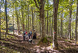
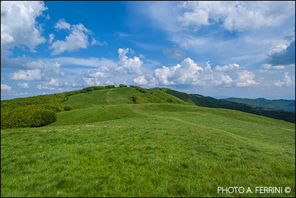
  It is a very demanding route that will make us appreciate the beauty of the mountain ridge little, so we go right on the panoramic road. In a kilometer of slight descent we reach the 1240 meters of Pian del Lelli where, above the road, there is an equipped area among majestic beech trees. We have to pass right in the middle of this area to continue the journey, we can take the opportunity to make a first stop for a snack comfortably seated at a table, there is also a spring. From here, with a forest track inside the beech wood, in just over a kilometer we will climb to Prato Romito, on the Pratomagno ridge, at 1472 metres. Another climb, therefore, quite demanding, but if tackled calmly, in a natural environment completely in the shade, fatigue is hardly felt. At the end of the wood the path splits in two. To the right, in a flat way, it rejoins the CAI 53 which from Trappola goes up to Pozza Nera, we must keep to the left continuing to climb and immediately entering the clearing of the meadows on the ridge. In two hundred meters the path will join the CAI 00 (the last meters in the grass are almost invisible) at the lowest point of the wide grassy basin called Prato Romito. At this point we should go left towards the cross, we recommend instead of climbing the hill to the right for a hundred meters (beyond this is the basin of the Pozza Nera). From here we will have a wide and beautiful view of the stretch of ridge that we have to cover: up to the cross, then on Poggio Pianellaccio where there is the memorial stone to the Australian aviator Herbert Hinkler who crashed on this mountain in January 1933, then towards Poggio delle Portacce . Two hundred meters before reaching this last hill, we must turn left to follow the CAI 00 which descends to Varco ai Gioghi (Pratomagno tunnel). From Prato Romito, where we are, we have to cover about 3.5 kilometers of ridge to get to Varco ai Gioghi. It is useless and superfluous to try to describe this part of the itinerary. Every word would be reductive. The images on page 32 to 51 will do it much better. Thirty meters before Varco ai Gioghi we leave the CAI 00 to follow a path to the right that takes us down the driveway (Casentino side). We proceed through the short tunnel at the end of which we immediately turn right to take a forest track closed by a bar. It is the beginning of a road that in about 4.5 kilometers will take us back to Rocca Ricciarda, the beginning of a path in a wilder Pratomagno than the one we generally enjoy on the large meadows near the cross.
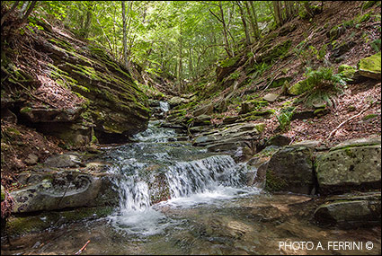
 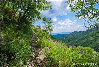 This last stretch of the itinerary is not identified as CAI, but apart from a stretch of three hundred meters at the end of which we will cross the Ciuffenna torrent for the second time (from right to left), where it is necessary to be more careful (the photos from pages 61 to 67 show the way well), in the first part we will walk on a forest track, then on a clear path. From Varco ai Gioghi, therefore, we begin a constant descent and after about 1.7 kilometers we will cross the Ciuffenna stream for the first time at a left bend. In this stretch we will meet some detours, we must continue on the main road. Beyond the stream we will walk along its right bank. Where the main road begins to climb, we will leave it to continue our journey on the track to the left, dirtier with vegetation, which continues to descend along the stream until its second crossing. From here begins a constantly uphill path that takes us to a beautiful panoramic point on the valley floor and on the steep and rocky slopes of the opposite mountain. The subsequent descent brings us closer to the stream which, with a succession of small waterfalls, flows in a narrow gorge. Turning left we will get back away from this and after a few ups and downs where we will meet the first chestnut trees, we will cross the Fosso del Diavolo with a footbridge. We are now a few hundred meters from the junction with the Loro Ciuffenna-Rocca Ricciarda municipal road. A few meters before entering it we will find on our right the Fosso del Diavolo which shows us some beautiful water features. Five minutes' walk on the municipal road and we arrive near the small village, next to that large inclined rock we mentioned at the beginning. If open, let's not forget a stop at the tavern to enjoy the delicious pancakes prepared with chestnut flour. We deserved it!


