From Vallombrosa on the Pratomagno ridge
an itinerary on Monte Secchieta and on the northern slopes of Pratomagno
Texts and photos by Alessandro Ferrini ©
70 images in sequence to learn about this itinerary in Pratomagno. Click to start the virtual excursion
From the Abbey of Vallombrosa to Secchieta. Return via Croce al Cardeto
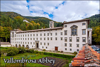
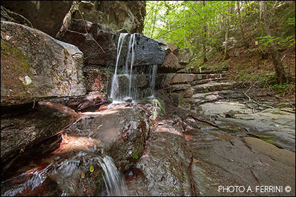
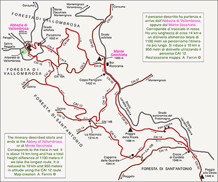 In these pages we describe an itinerary in the northernmost part of the Pratomagno massif. An excursion that will also introduce us to the most important place, from a historical, artistic and religious point of view, of the great mountain: Vallombrosa. A thousand-year-old abbey immersed in a lush forest. We find a brief description of this place in the first pages of the sequence. This route is a loop of about fourteen kilometres. The starting point can be Vallombrosa or Monte Secchieta, places that have an altitude difference of 450 meters. The total height difference of the route is 1100 meters. The itinerary can be reduced to ten kilometers and a height difference of 950 meters if on the Secchieta we immediately take the CAI 12 towards La Macinaia - Vallombrosa. The map clearly shows us the route and this possibility of shortening. The most popular walk, in Vallombrosa, is the "Circuito delle Cappelle" which begins on CAI 9, along the left wall of the monastery. The itinerary that we are about to describe also has this starting point, so we immediately face the hardest part of the route that climbs Monte Secchieta. Otherwise this peak could be another beginning of the excursion. An advisable choice on summer Sundays when it becomes difficult to find a parking space in Vallombrosa. Starting from up here, we can also choose a less demanding itinerary: seven kilometers and 650 meters of total altitude difference. After reaching Croce di Cardeto and then La Macinaia, we will go up Monte Secchieta using the CAI 12. We will still cross a stretch of the splendid Sant'Antonio Forest. We describe the longer route which starts to the left of the monastery using a pleasant paved path. After three hundred meters almost flat, turning left we cross the Fosso dei Bruciati which offers truly beautiful water features among the rocks. Here begins the Scala Santa along which we find three chapels before reaching the Paradisino, a large structure along the paved road that goes up to Monte Secchieta which offers us a wide panoramic view towards Florence with the Vallombrosan abbey below us. The CAI 9 crosses the
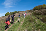
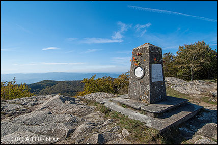
  road and enters the Biogenetic Natural Forest of Vallombrosa, here made up of fir trees. We take a breath because we have the steepest three hundred meters of the route ahead of us, then the climb will be less demanding. Meanwhile, the forest has become mixed due to the presence of beech trees. Higher up these plants will be the predominant ones. After about six hundred meters from the paved road we reach a crossroads where the CAI 9 continues to the right, we turn left following the signs for Secchieta – Variante. We enter the CAI 9A, a more recent route than the 9, a little longer but less demanding. It is now the most used, also advisable for the best maintenance. We find a paved driveway that looks like a canal in the woods. At the end of this, if we go out a few meters to the left, we will have a wide panorama to the west, practically the same seen from Paradisino, but from higher up. After 1.5 kilometers the route returns to CAI 9 which climbs very steeply from the right. Another five hundred meters and we reach the ridge of Monte Secchieta (about 1430 meters), not exactly on the top which is not far away, to the left (1450 meters). We have entered the CAI 00 of Pratomagno which up here, for a stretch of eight hundred meters, coincides with the driveway. At the crossroads between CAI 9 and 00 there is a refreshment bar, an excellent opportunity for a break at the end of the most demanding stretch of the itinerary. We continue our journey on the CAI 00 towards the south. After two hundred metres, on the right, we find a chapel and, a few meters from this, a memorial stone for the partisans who fought on this mountain. At this point, the absence of tall vegetation along the ridge allows for wide views both to the east and to the west. In the latter direction we see the upper part of the Upper Valdarno up to Florence. In the opposite direction we have a view of the Casentino and the Tuscan-Romagna Apennine ridge. We continue on the 00 and after
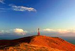
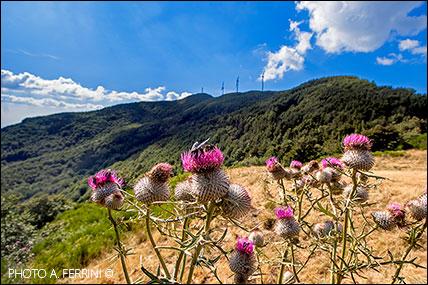
  three hundred meters we find, on the right, the beginning of the CAI 12 which takes us down to La Macinaia in twenty minutes through the beautiful Forest of Sant'Antonio. As already mentioned, this detour can be a possibility to reduce the itinerary by five kilometres. Two hundred meters beyond the crossroads with the CAI 12, the 00 leaves the driveway to keep further to the right, near the ridge. After less than a kilometer we pass by Poggio della Risala, the highest peak in this area of the Pratomagno, 1488 metres. Several large telecommunications pylons have accompanied our journey along this first part of the CAI 00. They are not the maximum expression of ecology, but after so many years they are now part of this mountain environment, as are the three large wind turbines to which from Poggio della Risala we arrive below in five hundred meters of slight descent. These gigantic metal structures are considered the symbol of Monte Secchieta as they are clearly visible from many areas of Pratomagno and the Casentino valley. A hundred meters beyond the last shovel, the CAI 00 begins a constant descent towards a saddle on the Pratomagno ridge: Croce al Cardeto. Even before arriving at the lowest point of the saddle, our itinerary turns right onto the CAI 14 heading towards the Capanna delle Guardie, inside the Sant'Antonio Forest. If you want to enjoy a beautiful panorama before setting out on this route, we recommend that you continue on the ridge at 00 and climb the col opposite to the one from which you descended for two hundred meters: Poggio alla Cesta, 1448 metres.
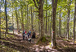
  We will see the road just made with the wind turbines above and, just to the left, a beautiful panorama of the valley floor where, in the absence of mist, we will see a good part of the city of Florence. Let's now set off on the CAI 14, an educational path because it is correlated with descriptive panels. A wide and almost flat road inside the beautiful Forest of Sant'Antonio, here made up of beech trees, which in 1.3 kilometers leads to the Capanna delle Guardie, today a refuge with a welcoming equipped area around it. From this place we have an extraordinary panorama of the western slopes of Pratomagno and the Valdarno. Considering the characteristics of this first part of the CAI 14 and that Croce al Cardeto can be reached by car, this short stretch of our itinerary can also be recommended to those people who cannot face walks of a certain physical effort. Beyond the Capanna delle Guardie, the CAI 14 becomes a path which, with ups and downs through woods and clearings, after one kilometer joins a forest road that climbs from the left. We go right and in a few minutes we arrive at La Macinaia, 1314 meters above sea level. A private building which also reaches the CAI 12 that descends from Monte Secchieta. We take this path to the left, in the direction of Vallombrosa. An almost constant descent on a wide road inside the Forest of Sant'Antonio. After a couple of kilometers the CAI 12 turns left towards Saltino, we keep to the right onto the CAI 10. The new route descends more decisively, in one stretch it is a sort of canal in the wood which here has returned to being a fir tree. Near a crossroads to the right (CAI 10A which takes you back to CAI 9 in a few minutes) the road becomes paved and has retaining walls. An unequivocal sign that it
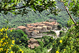
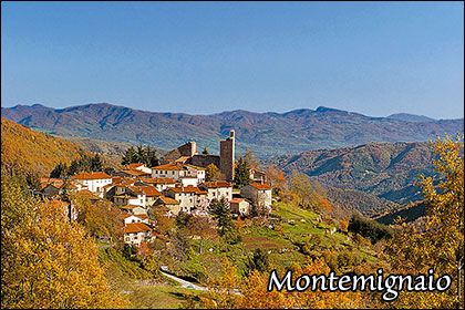
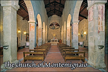
 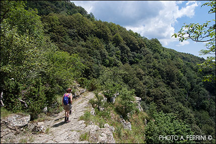 was an important route. It was used by Vallombrosans to reach the ridge of Pratomagno, a route which for centuries has represented a "highway" in the area's ancient road network. Also, in the summer the monks took their flocks and other livestock to the large pastures on the top of the mountain. From the crossroads, in just over three hundred meters we reach the paved road that goes up to Monte Secchieta, a short distance from Paradisino. After crossing it, in about two hundred meters we arrive at the fence that delimits the Arboretum of Vallombrosa. We turn right and in a few steps we find ourselves near the large tower along the right side of the abbey. Here there are tables and a spring, an excellent place to rest while enjoying a sandwich. The excursion can be considered concluded, we had started on the opposite side of the great monastery. Before leaving Vallombrosa, let's take a walk on its large lawn. From here we see Monte Secchieta, we came down from there. Being in Casentino, the shortest way to reach Monte Secchieta and Vallombrosa is the one that passes through Strada in Casentino and Montemignaio. For the first village we have invited you to stop on the itinerary that takes us to the Gastra gate and the Uomo di Sasso, now we recommend a visit to the second village. The description of this village of medieval origin and its Romanesque church can be found in the last pages of the sequence.


