Walking through history, legends, faith and nature
an itinerary between the Monastery and the Hermitage of Camaldoli
Texts and photos by Alessandro Ferrini ©
60 images in sequence to learn about this itinerary in Pratomagno. Click to start the virtual excursion
An itinerary from Camaldoli to Prato alla Penna and the Cotozzo Refuge
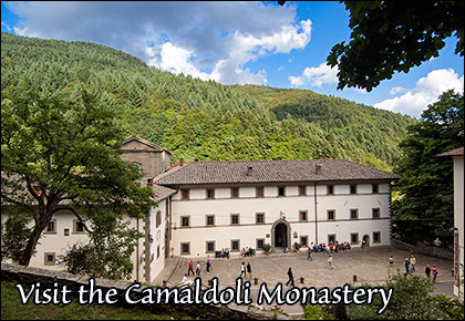
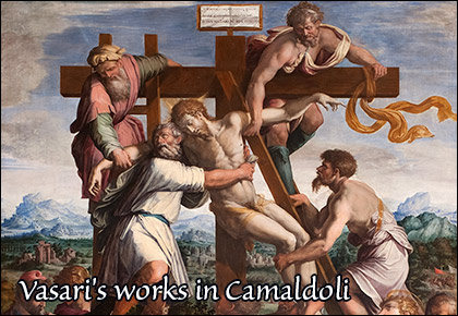
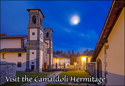
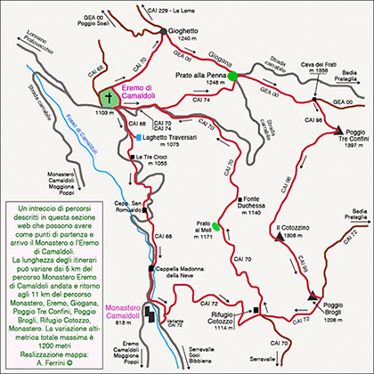 In this web section we describe three routes with a length of between five and eleven kilometres and a total difference in altitude of between 600 and 1,200 metres have as their reference points the Monastery and Hermitage of Camaldoli, Prato alla Penna, Poggio Tre Confini and the Cotozzo Hut. By following the map, the itineraries will appear very clear to us. The description will also illustrate various historical aspects concerning these routes. The Hermitage and the Monastery of Camaldoli are separated, as well as in their function, by almost three hundred metres of altitude and united, since their foundation, by 2.5 kilometres of road climbing steeply between massive fir trees. There are many who, after visiting the Romanesque cloisters of Maldolo, the monastery, the church embellished with paintings by Giorgio Vasari and the ancient pharmacy, walk up to the Sacred Hermitage. Here, the silence enveloping the twenty cells of the hermit monks, enclosed by a sturdy wall and a crown of fir trees, contributes to giving this place an air of mysticism. The path that has united hermitage and monastery since the foundation of Camaldoli, today CAI 68, meets, and for short stretches overlaps, the winding paved road, known as ‘Corta di Camaldoli’, which in three kilometres joins the two religious complexes. This road is closed to traffic in winter. CAI 68, on the other hand, is always open. In the snow, it is much used by snowshoe lovers. The route, as mentioned, is rather steep. However, it does offer more reasons to make a stopover, for example to admire from below some imposing fir trees standing right along the path; this view makes us feel extremely small. The starting point of the itinerary is in front of the Camaldoli Ornithological Museum, in the Carabinieri Forestali building. In the first section, CAI 68 coincides with the long straight flat road. After the first curves, when the climb begins, we find, on the right, the Madonna della Neve Chapel and a small stone bridge that crosses the Fosso di Camaldoli. It was built in 1456 when Mariotto Allegri was prior of the Camaldolese Order and underwent substantial restoration in 1915. Probably, the Chapel of the Madonna della Neve is older than the bridge. It is smaller in size, but has the same architecture as another, older chapel dedicated to San Romualdo which we will meet a little higher up, always along the way. Beyond this, we continue uphill on CAI 68. Shortly after, at a junction with the paved road, we find the ‘Three Crosses’. Until 1866 they marked the low border of an area reserved for hermit monks, where they could move freely in silence and solitude. This boundary marked by the crosses tells us that the Camaldolese hermitage is now close by, so we resume our walk knowing that our effort is almost at an end. Three hundred metres before the sacred place, CAI 68 enters again the driveway.
  A few steps before this junction, you should make a short diversions to the right to visit the Traversari Lake. This is a small artificial basin, now considered natural given its age. It was built as a fish farm in the first half of the 15th century by Prior General Ambrogio Traversari. A few more minutes of walking and we reach the Sacred Hermitage where we can admire its architecture being perfectly in harmony with the forest, the art in the church, the cell of Saint Romuald. Above all, we can soak up the mystical atmosphere of peace and silence that envelops the place. Once the visit is over, we return to the monastery using the usual route. The route, however, although a little challenging for the climb, is not demanding for experienced trekkers. For this reason, we propose two other itineraries which, always taking the Monastery and the Hermitage of Camaldoli as reference points and passing along the stretch of CAI 68 described, with a few more kilometres offer us other naturalistic aspects of high value and some more historical insights. After reading the text and studying the map, everyone can choose the route they prefer according to its length and altitude difference. The first of the two routes that we are going to describe has a length of about 11 or 11.5 kilometers. This small difference depends on whether from the Sacred Hermitage (1103 meters) we reach Prato alla Penna (1248 meters) directly using the CAI 74 or first we go up to Passo Gioghetto with the CAI 70. In the second case we will cover 700-800 meters almost flat of that stretch of Apennine ridge Tuscan-Romagna called Giogana. The total altitude difference of the entire itinerary remains almost the same: 1200 metres. The starting point from the hermitage will be its right front or right rear corner depending on whether we use the CAI 74 or 70. Both routes will initially make us walk among mighty fir trees, then the forest turns into a lush beech forest. Prato alla Penna, where the driveway then descending to Passo Fangacci and Badia Prataglia also arrives, boasts an amazing view, filtered by the vegetation, of the Lama Forest and Ridracoli Dam below. The wide clearing on the Apennine ridge is crossed by GEA 00. Having taken this path towards the south-east, in little more than a kilometre of ascent among the beech trees we reach Cava dei Frati (1,385 metres).Here, the GEA 00 begins to descend towards Passo Fangacci, we turn right onto CAI 98, which in five hundred metres leads to Poggio Tre Confini, the ‘roof’ of the excursion, 1,397 metres. The name of this hill has a precise meaning. Since the 11th century, the border between the territory of the Camaldolese and that of the Abbey of Prataglia passed through this area. Along the path between Cava dei Frati and Poggio Tre Confini, we find two large stones like thick gravestones embedded in the ground.
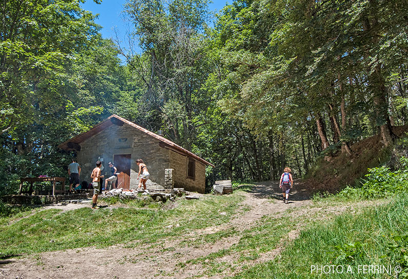
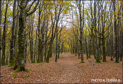
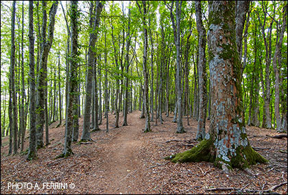
  On the side facing west the Camaldolese coat of arms (chalice and doves) is carved, on the other side the date 1853 is chiselled. These are terms, i.e. markers of a boundary; in this case, it was the one that separated the territory of the Camaldolese monks from that acquired by the Grand Duke of Tuscany Leopold II of Lorraine in 1852. From Poggio Tre Confini, CAI 98 heads towards Poggio Brogli (1,206 m), which we reach after about two and a half kilometres. Initially the path goes down quite steeply, then the descent becomes gentler and runs through a wonderful beech forest, it seems as if we are walking inside a fairy tale. After passing Il Cotozzino (1,308 metres), CAI 98 again descends more steeply to Poggio Brogli, where we enter CAI 72, which connects Badia Prataglia and the Monastery of Camaldoli towards which we must head, then turn right. In one kilometre we arrive at Cotozzo Hut (1,114 metres), which appears to us at the end of a sort of gully with the road as its bottom and mighty dark fir trees as its walls. The building, today a welcoming mountain hut with a fountain and cooker, was originally the home of the guard who watched over the Camaldolese forests. At Cotozzo Hut, CAI 72 meets CAI 70, which, to the left, leads to Serravalle, and to the right, back to the Hermitage of Camaldoli. We are going to describe this second stretch of CAI 70 in a few lines, but let us keep it in mind from the outset because it can be part of an alternative itinerary similar to the one we are following, but not including the monastery and whose starting and finishing point is at the hermitage. It is shortened by not even one kilometre, but the overall difference in height is considerably reduced to 760 metres. This time we started from the Camaldolese monastery and it is here that we must return. At Cotozzo Hut, we continue on CAI 72, which in less than two kilometres of descent, steep in places, takes us back to the starting point of the excursion. The second itinerary is about eight kilometres long and has a total difference in altitude of 780 metres. The starting point is still at the monastery, in this case on the opposite side of the bridge, a few steps from the left bank of the Fosso di Camaldoli. In the first two kilometres it follows the final part of the first route, CAI 72, but in the reverse direction.
  From the monastery at 816 metres, we ascend to the Cotozzo Hut at 1,114 metres where we take, on the left, CAI 70, which leads us to the Sacred Hermitage in just over an hour. The route, more than a path, is a road in the forest. From Cotozzo, in 1.5 kilometres we reach Prato ai Meli at 1,171 metres, the highest point of this second itinerary. From here we begin to descend and after five hundred metres we find, on the right, the Fonte della Duchessa (1,140 metres). Another kilometre and a half in the splendid Camaldolese forest, and CAI 70 joins the paved road that goes up to Prato alla Penna. We descend this road to the hermitage where, with CAI 68, described in the opposite direction at the beginning of this chapter, we return to the large monastery. The sequence of sixty pages in this section shows and describes in detail (up to page 52) the longer itinerary, the one that starts from the Monastery of Camaldoli, climbs to the Sacred Hermitage, reaches Giogana and Prato alla Penna via the CAI 70 or 74. From here via the GEA 00 it arrives at Cava dei Frati, then, with the CAI 98 at Poggio Tre Confini (roof of the route, 1397 metres). Again with the CAI 98 it descends to Poggio Brogli from where, with the CAI 72, it reaches the Cotozzo Hut and then the Camaldoli Monastery, the starting point. The last eight pages of the sequence (53 - 60) show the section of the CAI 70 which from the Cotozzo refuge leads to the Camaldoli hermitage passing through Fonte della Duchessa. After observing the map, seeing from the sequence what the various routes offer from a cultural and naturalistic point of view, everyone will choose the itinerary, not least also on the basis of the physical effort they present.


