With Guido Monaco to the Santa Trinita Abbey
itinerary from Pontenano to the Benedictine abbey of Santa Trinita and to Anciolina Pass
Texts and photos by Alessandro Ferrini ©
65 images in sequence to learn about this itinerary in Pratomagno. Click to start the virtual excursion
Towards the Santa Trinita Abbey on a possible route by Guido Monaco
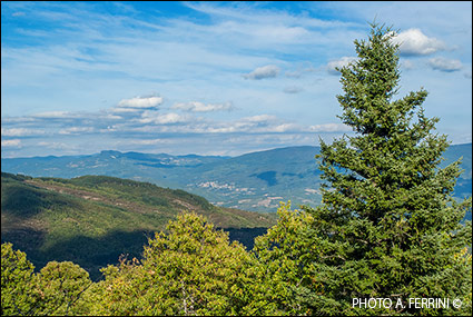
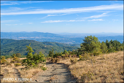
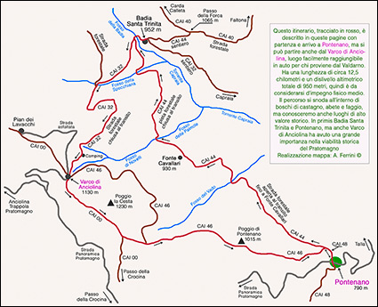 The starting and arrival point of the itinerary we describe in these pages is Pontenano, at 790 meters above sea level. Otherwise, another starting point could be the Anciolina pass at 1130 meters above sea level, reachable more quickly by those coming from the Valdarno and climbing the Pratomagno passing through Trappola or Anciolina. This circular route is approximately 12.5 kilometers long and has a total altitude difference of 950 metres. It is therefore to be considered of medium physical effort. We describe it in an anti-clockwise direction, so along the stretch of CAI 46 that goes down to Pontenano we will have an extraordinary view towards the south-east, i.e. over the city of Arezzo, the Valdichiana and the southern part of the Valdarno Superiore. The last two kilometers of CAI 46 towards Pontenano present a rather steep descent on a rocky surface which could bother those with knee problems. In this case it is advisable to tackle the itinerary in a clockwise direction.
Pontenano is a mountain village in the municipality of Talla. For those coming from Casentino, it is located 7.5 kilometers after the capital. For those who, however, find themselves in the areas of Arezzo, Castiglion Fibocchi and San Giustino Valdarno, the fastest way to reach Pontenano is to take the first five kilometers of the Crocina Pass and then a stretch of the Pratomagno panoramic road up to the road, right, which in four kilometers leads to this mountain village.
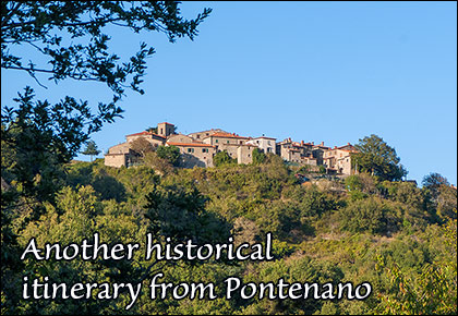
Arriving from Talla, three kilometers before Pontenano we find another small town that deserves a short visit: Pieve di Pontenano. This name already tells us something about the place. The baptismal church of the Pontenano Castle was located here. We see this village and it is described in the first six pages of the sequence. We take the municipal road that leads to Pontenano, a place with a very ancient history behind it. In this regard, there are interesting testimonies within the small town and within a radius of seven hundred metres, a reason for short walks or another excursion described here.
The walk starts from the external square of Pontenano, where there is a car park and from where the road starts which in four kilometers leads to the Pratomagno panoramic road. We head in the opposite direction of the town. For two hundred meters we walk on CAI 48 which follows an ancient road that comes from the Crocina Pass. In the title of this page we read that we will go to the Abbey of Santa Trinita accompanied by Guido Monaco, an imaginary
  company, obviously. The place of birth of this great character is not known, nor where and when he died. It is known for certain that between 1025 and 1030, coming from the Abbey of Pomposa, he was in Arezzo invited by Bishop Teodaldo. They were years of study during which he invented what would become a language used throughout the world: musical notation. In those years Badia Santa Trinita was the reference point of Benedictine culture for a vast territory, Gregorian chant was sung and taught here. From these assumptions it is unthinkable that Guido Monaco did not go to this important abbey to meet and discuss with his brothers. Since the 12th century, the current CAI 48 was the communication road between the Castle of Pontenano and Arezzo. Why shouldn't it have been in Guido Monaco's time? From a geographical point of view there could be no alternatives. Not only that, this road and the one traced by the current CAI 44 that we are about to travel, represented the connection between Santa Trinita and Arezzo, on whose bishopric the abbey depended.
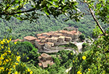
Let's start the excursion, ideally accompanied by Guido Monaco. After two hundred meters the CAI 48 ends at a crossroads. We must go to the right where CAI 44 begins. The path on the left, which goes up, is CAI 46 which we will use for the return. We are entering an area that for centuries has been synonymous with wealth, the territory of the Municipality of Talla where the most productive chestnut forests in terms of firewood, coal, timber and chestnuts were located. Not only that, woods that allowed the breeding of many pigs. In the first kilometer and a half on CAI 44 we do not cross chestnut forests of particular beauty. On our right the forest is quite sparse and allows us to have a beautiful view of the valley floor, the small village that we see perched on the slopes of the mountain in front is Capraia, a castle subordinate to Pontenano destroyed in 1502. At the beginning of a climb the forest becomes denser. On a bend to the right we cross the Fosso del Vado, from here in just over a kilometer we arrive at Fonte Cavallari (930 metres) where we see two houses. The toponym already tells us something. Meanwhile, there is a spring, but we cannot use it because it has become inaccessible, then a tradition tells that in an unspecified period horses were taken care of here. CAI 44 brought us here from Pontenano in 2.8 kilometres. A route that corresponds to a forest road that is passable, with a little care, even with motorized vehicles. From Fonte Cavallari to Badia Santa Trinita there are just over two kilometres, this means that the CAI
 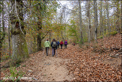 44 from Pontenano is the least demanding route to reach the ancient abbey, about five kilometers (one way) with an active difference in altitude of 240 metres. Considering that we can get to Fonte Cavallari by car, the walk can be reduced to just over four kilometers in total.
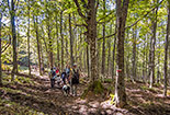
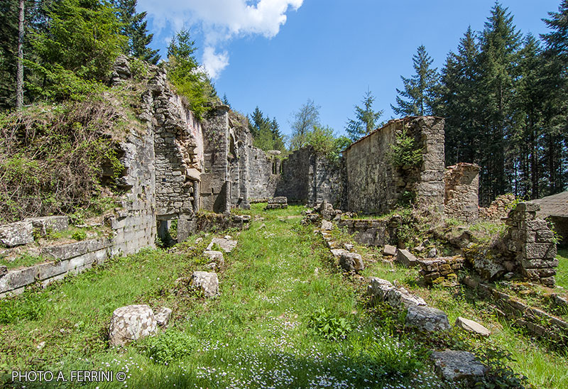
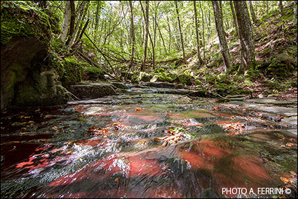
Continuing, the forest becomes even more beautiful. The chestnut will be the prevalent plant, but we will also find beech trees and a small Douglas fir forest. In five minutes we arrive at Fosso delle Palmole. Beyond this watercourse, up to a barrier, upstream from the road there is an area called Badia Vecchia, a toponym that leads one to think of a settlement of Santa Trinita prior to the current one. On the other hand, the fact that today's site of the abbey was not the first is also reported in some ancient documents. After the Fosso delle Palmole, in about a kilometer we arrive at the Fosso della Specchiana. Twenty meters before the watercourse the path forks. We must continue to the right, going down. First, however, let's go left, slightly uphill. After fifty meters we will find a waterfall, small but very beautiful due to the movements of the water. We go back on CAI 44 and cross the ditch. If we feel like going off-piste for a short time (the ground is better not wet) we can descend it for about thirty meters along its left bank. We will observe the beauty of the pavement where the water flows, due to its conformation and because from late spring to autumn a red algae forms there which, if illuminated by the direct rays of the sun, becomes almost phosphorescent. Beyond the Fosso della Specchiana begins the so-called Selva della Badia: a chestnut grove that was a real asset for Santa Trinita, from the time of the monks until the 1950s when it was inhabited by Adone, the last farmer of the Cassi, to that time the owners of the place. After crossing the Selva della Badia (about 400 metres), CAI 48 joins CAI 32, a forest road that descends from the Anciolina pass. The two paths, overlapping, cross the Fosso della Badia a few meters below on a small wooden bridge, then begin a short climb inside a thick fir tree on top of which the ruins of the Abbey of Santa Maria appear suddenly and fascinatingly. Trinita (952 meters above sea level). The first thought that comes to mind is how a monastic complex of such importance could have arisen in a mountainous and pleasant place like this. This was not the case when it was built. The Camaldolese Annals tell us that Badia di Santa Trinita in Alpe was founded by
  direct will of Otto I of Saxony between 950 and 961 by two German Benedictine monks, Pietro and Eriprando, along the Via Abversa, a route of great importance probably of Etruscan. Much more information about the abbey can be found on pages 33 to 39 of the sequence.
The CAI 44 and CAI 32 routes, overlapping, lead us behind the abbey where we can observe the apse largely rebuilt between 1968 and 1970 when Santa Trinita was subjected to extensive restoration work. A few meters from this architectural element is the Fonte della Badia where the two paths divide. CAI 32 turns right heading towards Capraia, CAI 44 continues straight and after a few meters a steep climb begins which in seven hundred meters leads to Passo della Forca (1065 metres) where it joins CAI 40, a forest road open to vehicles motorized vehicles which heads towards Faltona on the right. We see this last road indicated in a cadastral map from 1824 as Strada del Valdarno. We find the same indication on the road corresponding (in principle) to CAI 32 which we will follow in this second part of our excursion. What does this mean? We are walking on the Via Abversa, the historic route we have already mentioned. To strengthen this hypothesis, the ditch that we crossed two hundred meters before reaching the abbey, a little further up, in the usual map, and other more recent ones, is indicated as the Ditch of the Via Traversa.
We leave Santa Trinita taking the road we arrived on. A few meters after the bridge, CAI 44 turns left, CAI 32 continues straight, going up. We follow this second route which follows a forest road. In three kilometers we will arrive at the Anciolina pass (1130 metres). Initially our path is accompanied by a chestnut grove with some centuries-old plants, then the forest becomes mixed due to the presence of fir trees. In a kilometer we come to a crossroads where we go left. Here the beech has become the prevalent plant. Another kilometer and the road becomes almost flat. From here we begin to cross that area marked on the maps as "Badia Vecchia" or "Badivecchia". Interesting toponym, as already mentioned, here there was certainly the first settlement of Santa Trinita. A place almost 1100 meters high and exposed to the icy north wind, perhaps this is why the Benedictine monastery soon
  moved to its current site close to the mountains that protect it from the north and east. In just over five hundred meters we arrive at the Fonte dello Squarto campsite and in another five minutes at the Anciolina pass, more simply known as "Varco" since this is the pass par excellence, the most important in Pratomagno. Probably because here the mountain was crossed by the road par excellence: the ancient Via Abversa.
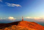
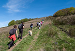
At the "Varco" the CAI 32 joins the CAI 00 on the ridge which we take towards the south. We are about to cover the last 4.5 kilometers of the itinerary which will take us back to Pontenano. In less than a kilometer we reach the highest point of the route (1200 metres), that is, near the top of Poggio la Cesta. From here a steady descent begins and after a few hundred meters we arrive at a crossroads where the CAI 00 turns right, we continue straight on a forest track which after three hundred meters joins the CAI 46 which comes from the left and goes down to Pontenano. This last stretch of the route is much poorer in woods than what we have encountered up to this point. We are in a drier and therefore bushier area. On the other hand we have more views which become very wide and spectacular when we reach Poggio di Pontenano from where, towards the south-east, we can distinguish the city of Arezzo and, if there is no mist, Valdichiana and Lake Trasimeno. We are at around 1000 meters above sea level, in just over a kilometer we will go down to 790 meters above sea level in Pontenano. A descent, therefore, quite steep and on a rocky surface. Let's proceed with caution to show respect for our knees.


