THE GERMANIC VIA ROMANICA,
an ancient road that from northern Europe reached Rome


YOU MIGHT BE INTERESTED


Texts and photos by Alessandro Ferrini ©
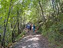
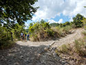
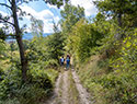
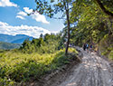
90 images in sequence to see the extraordinary route of the Via Romea over the Apennines. Click to enlarge
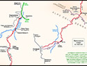

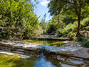
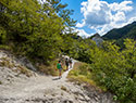
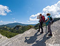
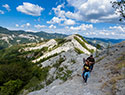
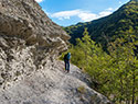
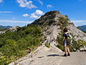
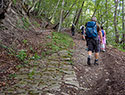
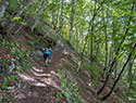
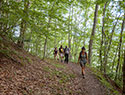
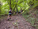

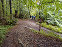

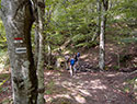
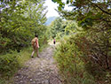
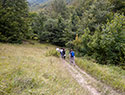
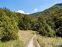
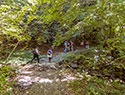
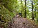
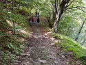
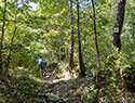

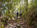
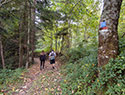
The Via Romea and its tuscan-romagnola tract on the Pass of Serra


The term Via Romea literally means road to Rome and in the Middle Ages this name was used to identify the main roads used by pilgrims directed to Rome from various places in northern Italy and Europe. The well-known road called the Via Francigena was also a Via Romea, used by the Franks and the people from the north west of Italy heading to the Pope's city.
In modern times the name Via Romea indicates a single road of great logistic importance along the romagnolo-veneto coastline, the SS309 or the European E55. But this important road with its heavy flow of traffic is none other than a reconstruction of the medieval Via Romea. The name has remained and it's no coincidence that it leads to Byzantine Ravenna of Dantesque fame and the ninth century Abbey of Pomposa.
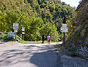
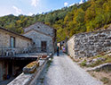
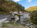
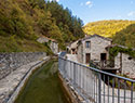
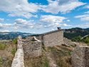
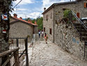
This road, to be called Romea (also known as Stade because of the detailed description of it given in the Annals of the Abbey of Stade in the mid-thirteenth century), had, of course, to lead to Rome. Near Forli it took this direction by veering right meandering into the Bidente valley to then arrive at Bagno di Romagna. A couple of kilometres from this town, in the historic and once economically important Gualchiere district, one of the most difficult but definitely fascinating stretches of this road begins: the crossing of the Appenines.
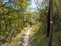
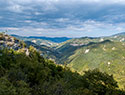
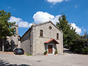
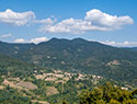
With an almost continuous ascent of six kilometres and a change in altitude of 650 metres it reached the Appennine ridge, which it crossed over the Pass of Serra. Then a steep descent to cut through Vallesanta in Casentino, practically halfway between two important devotional sites, La Verna and Camaldoli. linked to the figures of two great Saints: Francis of Assisi and Romualdo. In this area it touched upon the habitants of Serra, Corezzo, Frassineta, Pezza and Casa Santicchio. It then entered the territory of the present-dayl municipality of Bibbiena passing historical places like Giona and Banzena along the way. From here it descended towards Campi along the Corsalone river to then continue towards Arezzo. From this city of Etruscan origin it headed towards Orvieto and Montefiascone, following along the Val di Chiana, where it joined the Via Francigena. 
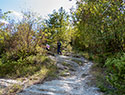
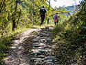
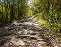
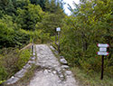
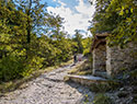
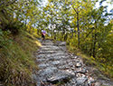
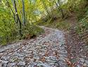
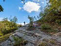
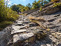
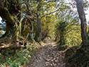
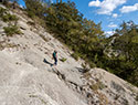
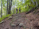
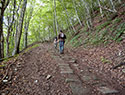
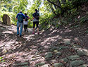
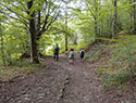
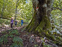
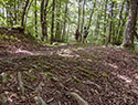
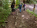
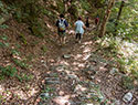
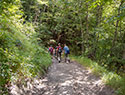
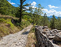
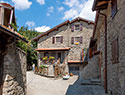
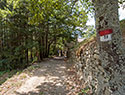
To describe the route this road takes we have used the past tense, but for the Tuscan-Romagna Appennine tract we have good reason to use the present tense. Here the Via Romea (often signposted VRG: Via Romea Germanic) still exists and it's extraordinary cobblestone paving provides the evidence.
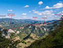
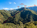
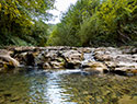
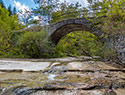
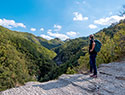
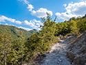
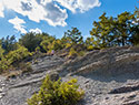
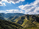
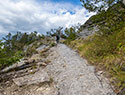
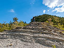
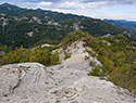
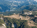
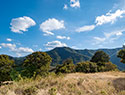
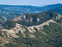
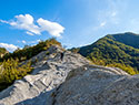
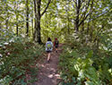
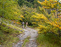
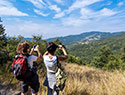
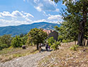
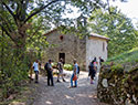
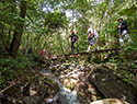
In this section of the web we will travel along this stretch of Appeninic road between Bagno di Romagna and Corezzo in the company of twenty first century pilgrims. A distance of approximately eleven kilometers, divided in half between ascent and descent, it starts at a height of 518 meters above sea level at Gaulchiere to climb to the Pass of Serra at 1148 meters and then drop to 760 meters at Corezzo. The photos and text in this section describe the cobblestone paving still very much in evidence along this stretch of road, demonstrating renovations which have taken place in different epochs, often very distant one from the other, and showing us the extraordinary views that can be enjoyed here, especially on the Romagna side where the spectacular badlands  transport us mentally to a "moon walk" landscape. Along the way we'll come across Podere Nasseto, a piece of fertile land in the midst of all this stone and will go from the barren rocks of the lower part on the Romagna side to the beech forests of the Apennine ridge.
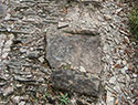
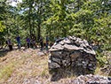
It's difficult to put a date on this road, it certainly dates back to before the time it could be called Romea, before it was used by pilgrims heading to Rome. It was the reference point connecting the area of Arezzo and lower Casentino with Romagna and Veneto, and this was well before the year 1000. In places its cobblestones are made up of large slabs of stone which are also very thick, bringing Roman times to mind. Various archaeological finds from this period in the Giona and Banzena area give strength to this theory.
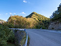
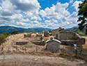
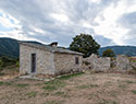
Although closer to us timewise it's also difficult to establish a date for the falling into disuse of the Via Pass of Serra (the name Via Romea was perhaps used several centuries ago and has started to be used again today as a consequence of understanding and appreciating its importance and history) . It could be said that the decline in its use began in 1882, with the opening of the Mandrioli mass and the resulting road which, although much longer, was much more convenient to use and also suitable  for heavy traffic (cart traffic at that time). Up until the Second World War the Pass of Serra had a transit that although gradually diminishing was still present and important for a vast area of the territory. In the second half of the twentieth century, however, with many homesteads and farmhouses being abandoned in Vallesanta as well as Podere Nasseto in the Romagna region, and with the gradual increase in the use of motor vehicles, it rapidly fell into disuse.
A road with, perhaps, two millennia of important history behind it could not, however, just die out, and we could say that it entered into a sort of progressive hibernation. Since the beginning of the twenty-first century, however, it is re-emerging, thanks to a cultural and sport-based tourism that is developing and seeking out the extraordinary particularities of this territory, like this road. This stretch of the Tuscan Romagna Via Romea is re-awakening because it is able to offer interesting historical, geological, archaeological and natural aspects to its "pilgrims", as well as thrills and physical fitness.
Ilbelcasentino.it is a realization of:
Alessandro Ferrini, 52010 Talla (AR) - P.Iva 01428280513
Tel. 339.4257840 - info@ilbelcasentino.it
All rights reserved


